
Eastward Bound
Tornados, heat, and a battlefield
Details
When - July 6th - 8th
Where - Colorado Springs - Springfield, MO
Miles - 751

It was hard to watch Pikes Peak disappear in my side mirror as I drove way from Colorado Springs. The mountains went brown and green to purple and then blue as I added on the miles. The mountains held on to the Springfield and I until we finally slipped their wispy grasp. I will be back.
I was bound for a KOA in Wakeeny Kansas and then a KOA in Springfield Missouri. I had 750 miles to cover in two days. I saw a sketchy forecast on the morning of departure. Tornados and hail brewing in Colorado, thunderstorms crossing Kansas, and extreme heat warnings in Missouri. I had a lot to keep my eye on as leg 6 of the Double Nickel Ride kicked off.
Eastern Colorado and Kansas are flat. I mean flat - similar to Montana big sky country. I had a park ranger in Missouri tell me that “everyone says Colorado is a great place to visit, but Kansas is in the way.” I agree! I stayed off the interstate as I finished Colorado and entered Kansas. Gas stops were few and far between, requiring me to plan carefully and no wrong turns. I am so glad I replaced the Zumo XT GPS. It did its job. I stopped regularly for water, snacks, and fuel. At lunch I could see I was 8 hours ahead of tornados and 4 hours behind thunderstorms, both systems heading East. My goal was to stay right in the middle. I did exactly that . I held up at a rest stop for 45 minutes to let the thunderstorm pass through the camp ground allowing me to stay dry.
The next morning I was up at 4am and rolling at 6am. As I was packing up a BMW rider came and asked for directions to the restroom. He later came back and told me he got caught in the Colorado tornado warnings and hard rain. He had to wait out a lot of the storm in a VFW. He was a cool guy. He was newly retired, reenacting a ride he did 30 years ago. I said my goodbyes and wished him luck, my goal was to stay ahead of the weather and beat the heat in to Springfield. That plan worked perfectly. It was all interstate and I put the hammer down. By lunch I logged 340 miles and was dry but warm. I then sprinted the last 130 miles in 100 degree heat to arrive at the Springfield KOA who had unfortunately closed their pool.
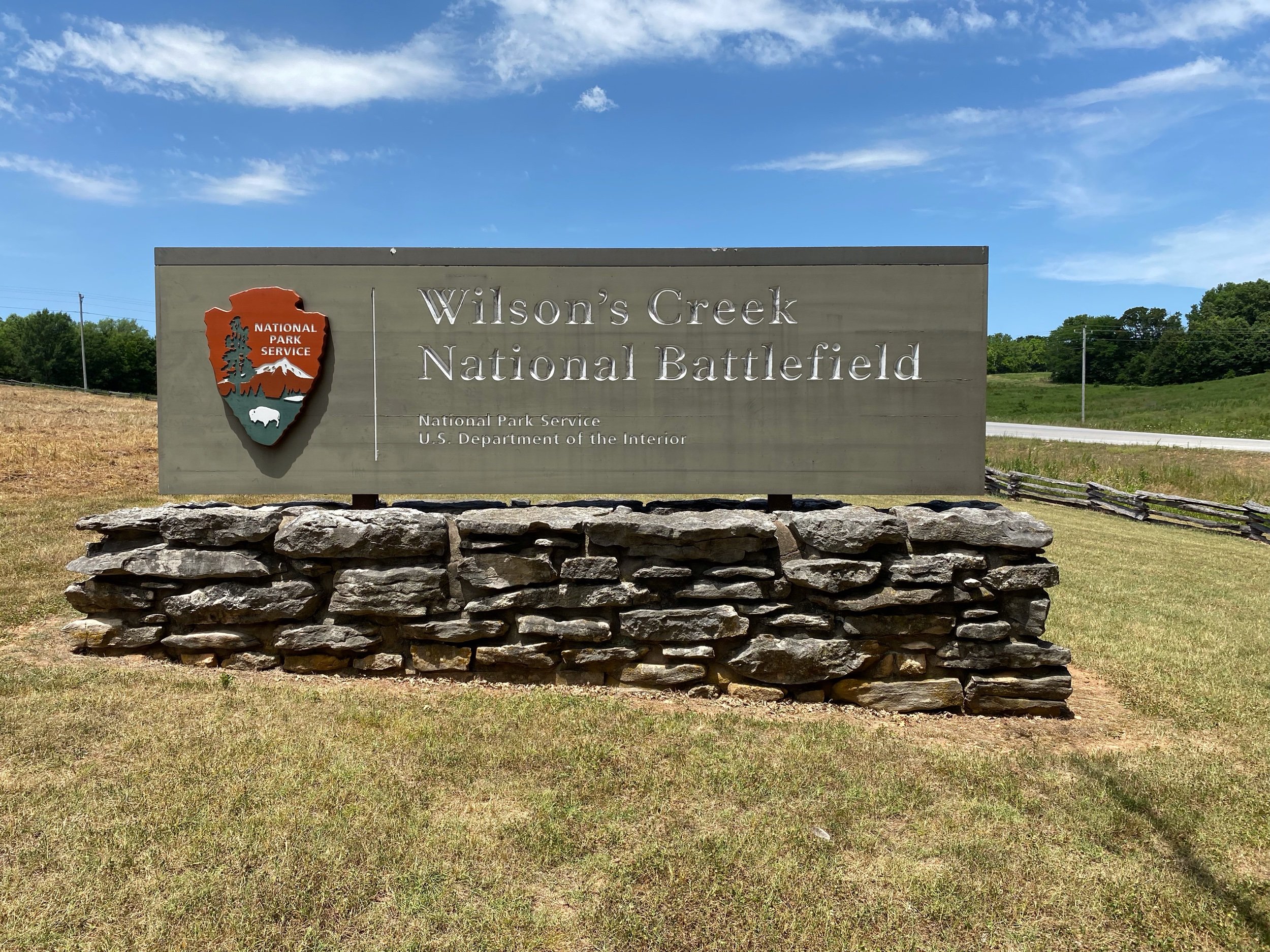
After a hot night in the tent. I was up early to visit Wilson’s Creek Battlefield, find Route 66 in Springfield, and visit a Springfield Museum. I did the battlefield first, but I will save that for last in the blog because not everyone enjoys Civil War history.
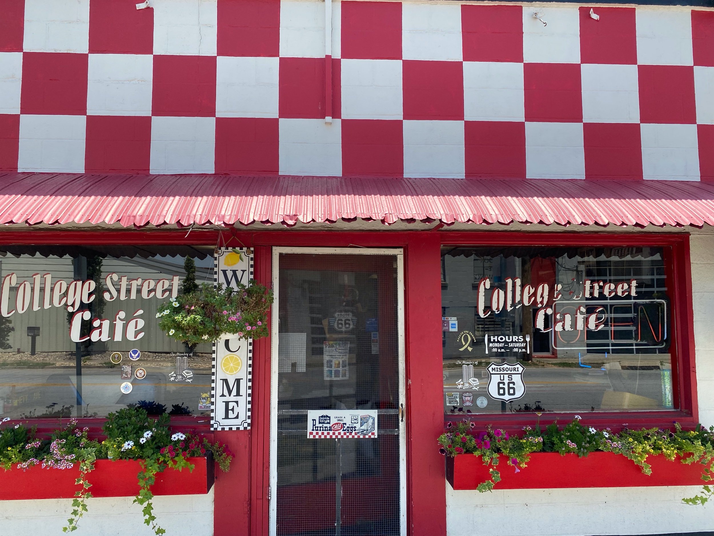
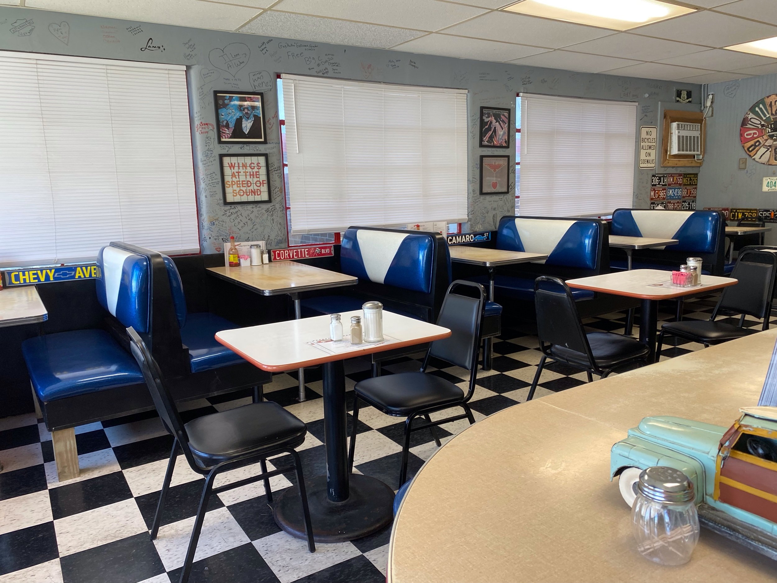
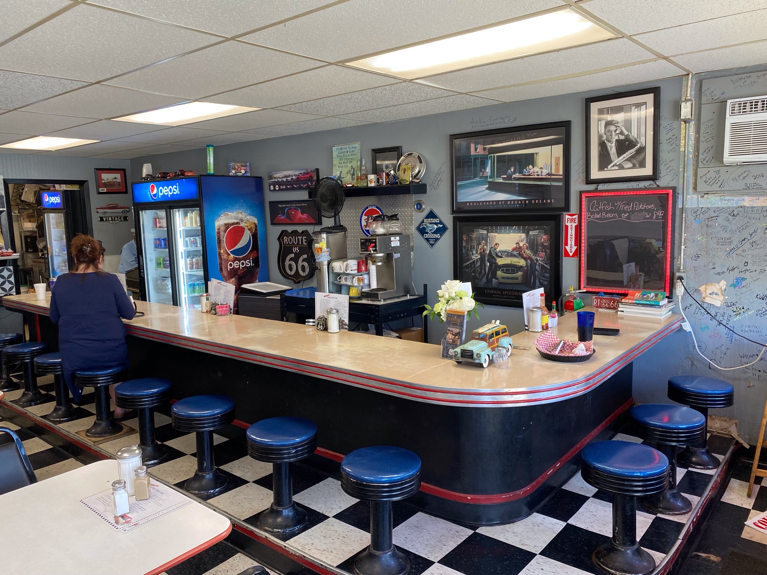
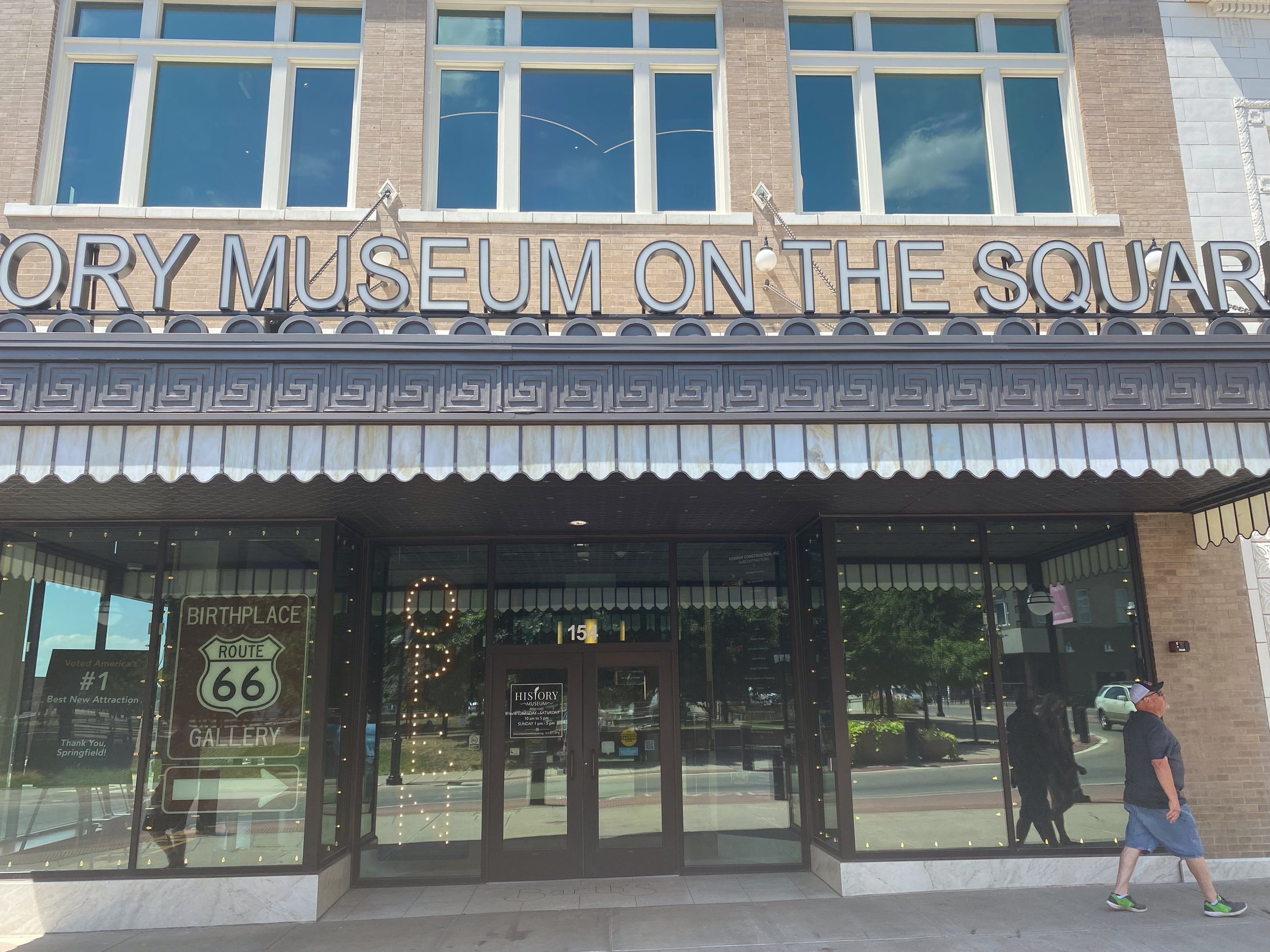
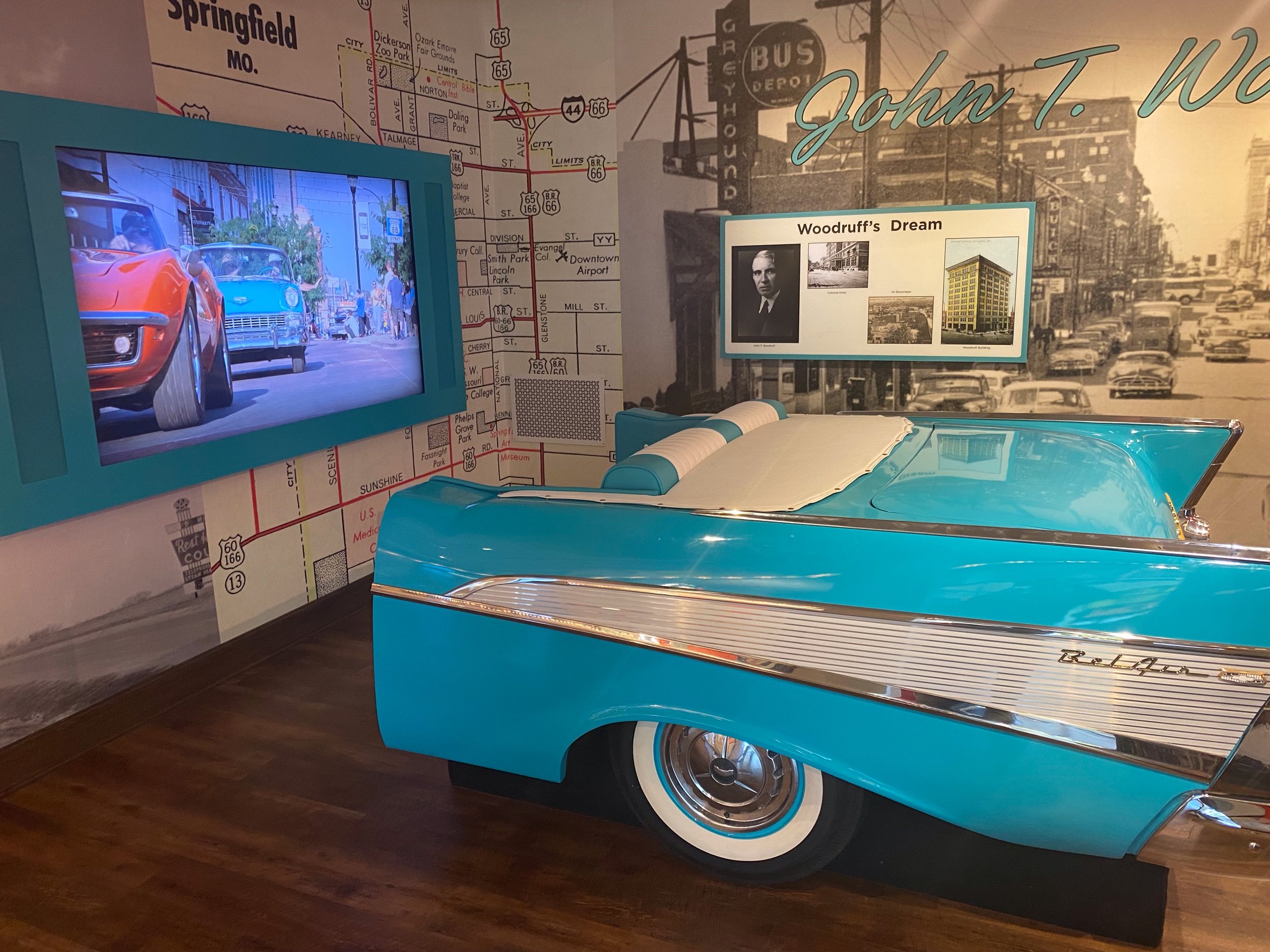
I found Route 66 in downtown and immediately found my diner. The College Street Cafe has been there on Route 66 since the 1950’s. It had a different name, but serving breakfast and lunch for a long time. My waitress helped me make a museum choice - it was 100 degrees and the Route 66 Car Museum did not have air conditioning. The newly opened History Museum on the Square was rumored to have the best AC in town. My decision was made. next stop downtown!

What a happy surprise this museum turned out to be. The museum is dedicated to Springfield being a cross road city and playing a major role in US history. It has five floors, with the first being how the town was settled and the number of Indian tribes that had been moved there and then moved again as white expansion moved West. The most powerful exhibit was dedicated to the Trail of Tears route that moved thousands of Indians west who were forced to leave their land. Springfield was a stop on the Trail of Tears. This was very powerful and informative, worth the price of admission on its own.
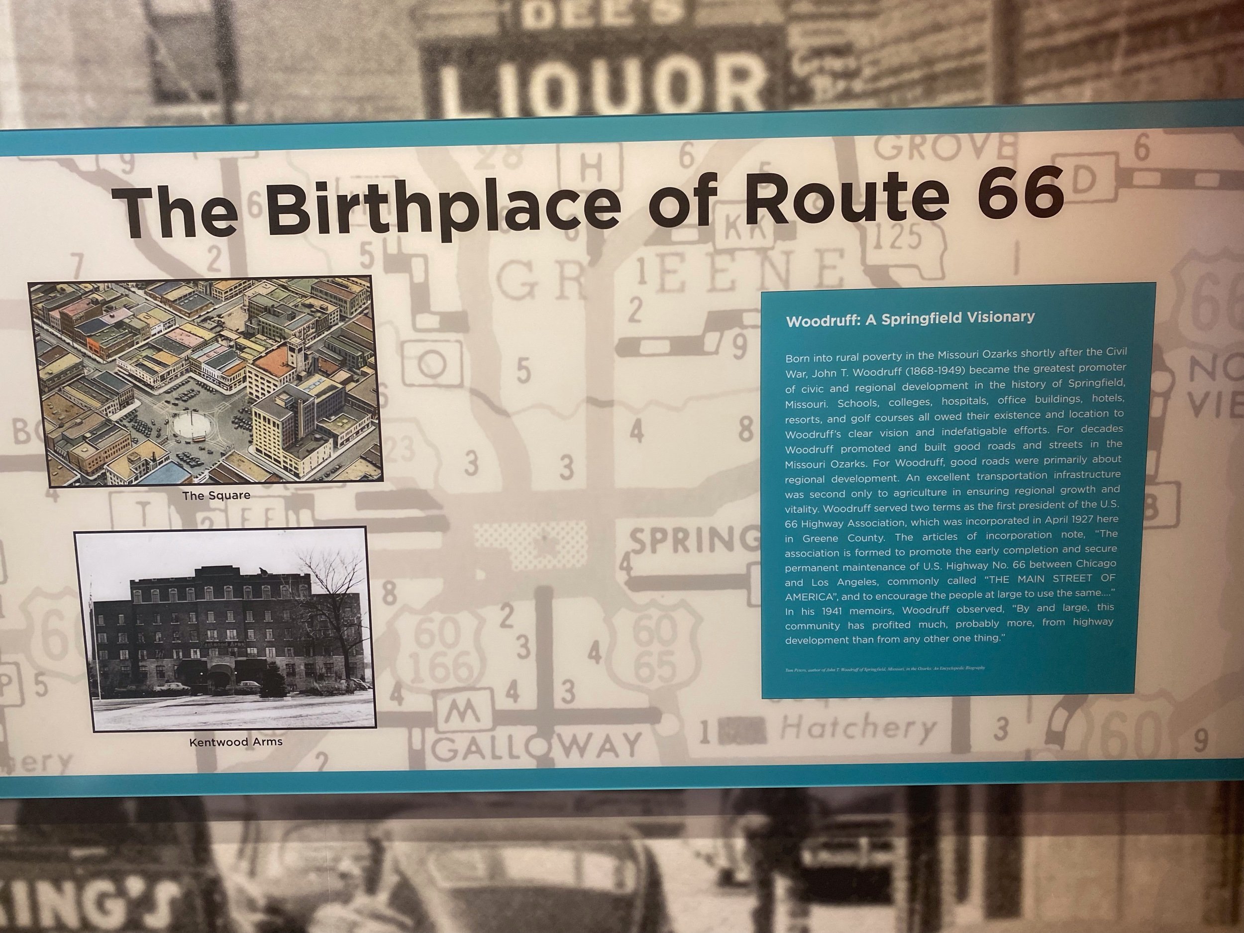
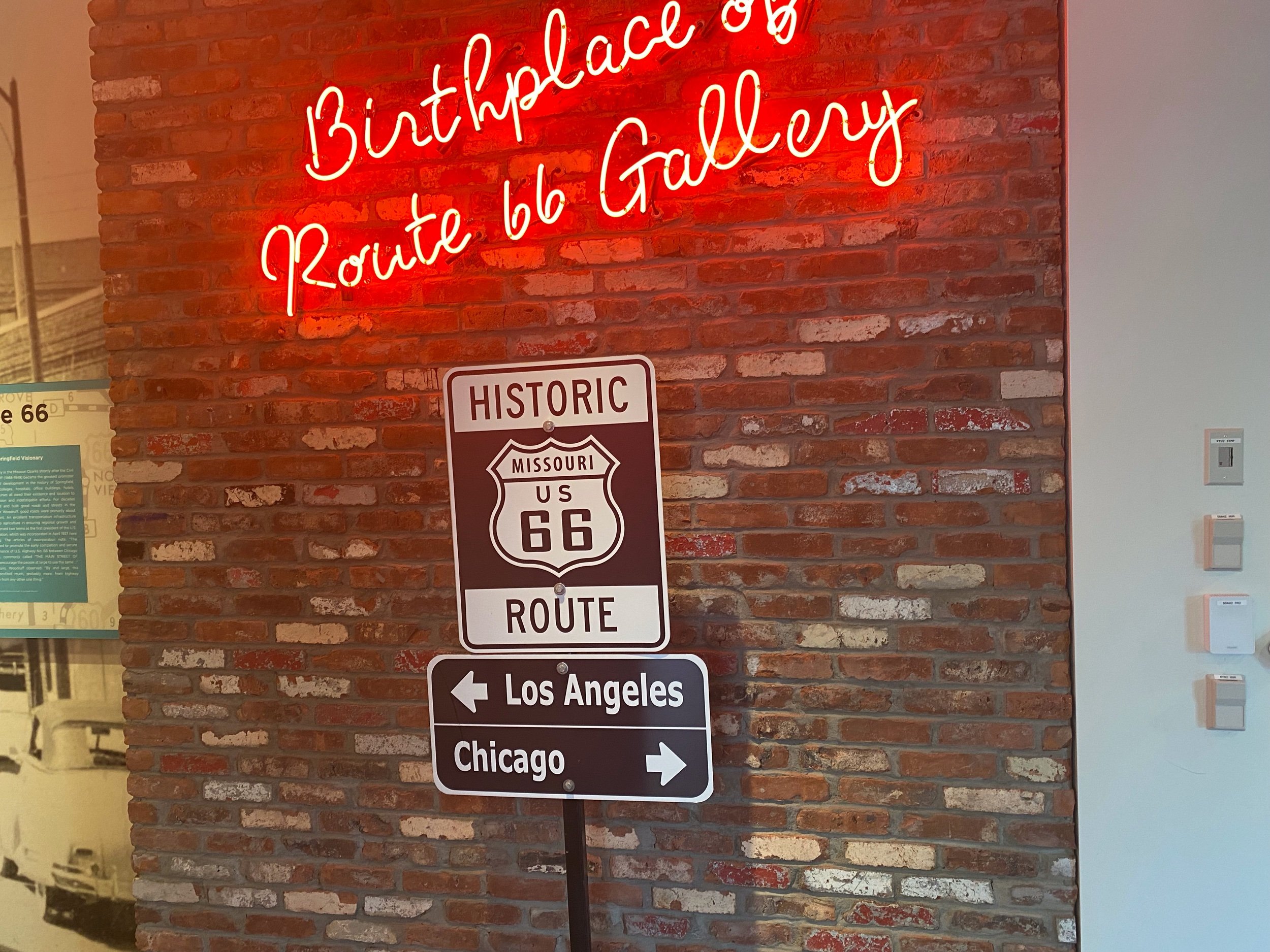
The reaming floors were dedicated to the Wild West and Wild Bill Hickok, trains and cable cars, Springfield during the Civil War, and Route 66. They call Springfield, MO the birthplace of Route 66, because their leaders proposed Route 66 as a compromise name, after much bickering between the states on the transcontinental interstate system. In my opinion a long putt, but had the cable message that proposed the compromise on display. They had some wonderful exhibits of the time line of the road and some awesome memorabilia. Route 66 was a road trip, where it was more about the journey and less about getting to a destination as quickly a possible. I wonder what today’s travel stops will like 60 years from now. I predict we will have flying electric cars and people will float down and visit the ancient relics of McDonalds, Chipotle, Cracker Barrel, and maga gas stations in wonder. Maybe they will find this blog and read how one old dude did it!
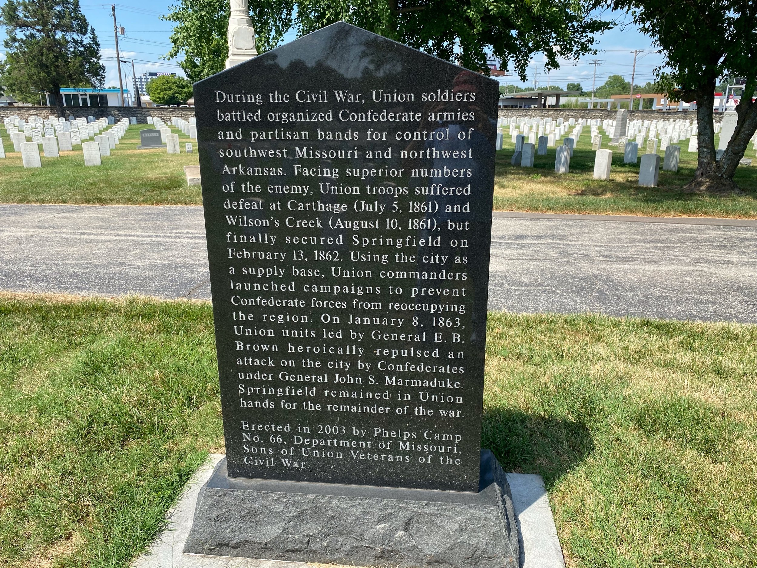
Wilson’s Creek Battlefield was a place I never thought I would visit. I was drawn to this battlefield because of my interest in General Nathaniel Lyon who died at this battle. You may remember that Missouri was a heavily contested state from it is original formation on whether it would be a slave or free state. It was divided and the same division persisted on whether to succeed with the confederacy or remain with the Union.
Gen. Lyon was assigned to the US arsenal in St Louis and was in the epicenter of keeping Missouri from succeeding. He famously shouted “This means War!” At a meeting where he was unable to negotiate a armistice with Confederate Generals McCulloch, Price, and Pearce. Lyon took the war to them. Heavily outnumber, Union forces 4,200 and combined conferderate forces of 12,000., Lyon marched and counter marced to keep the confederates on their heels. Finally, on August 10th, 1861, Lyon had intelligence that the confederate forces were massing near Wilson’s Creak to strike towards Springfield. He, Col. Frank Sigel, and Maj. Samuel Sturgis forged a plan to split their forces and catch the Confederates between a hammer and anvil.

In my opinion, the battle turned on two minor events. The night before, amazingly both armies were preparing to attack. The confederates pulled back their advanced pickets and prepared to move, but a rain storm caused a delay. The poorly equipped confederates needed to keep their power dry. This gave Lyon and Sigel the surprise advantage they were working towards. Sigel advanced through cornfields from north to south and pushed the confederates back quickly only to be stalled by effective cannon fire. Lyon had similar success and occupied high ground now known as Bloody Hill. Sigel’ s final poison was lost when they mistook advancing confederates as relief from another Union brigade. These similarly colored uniforms allowed the confederates to break Sigel and force them to retreat. This was the second minor event.
Now Price and Mculloch could turn their attention and reserves towards Lyon and the inbalance of numbers became apparent. Lyon and his artillery forced the confederates to pay an awful price to take Bloody Hill. Lyons himself was killed when he was working to reposition his troops after a confederates assault. This left Sturgis in command. With no word form Sigel and a clear mismatch in forces, he conducted an orderly retreat to Springfield. The confederate army was too tired and spent to pursue.
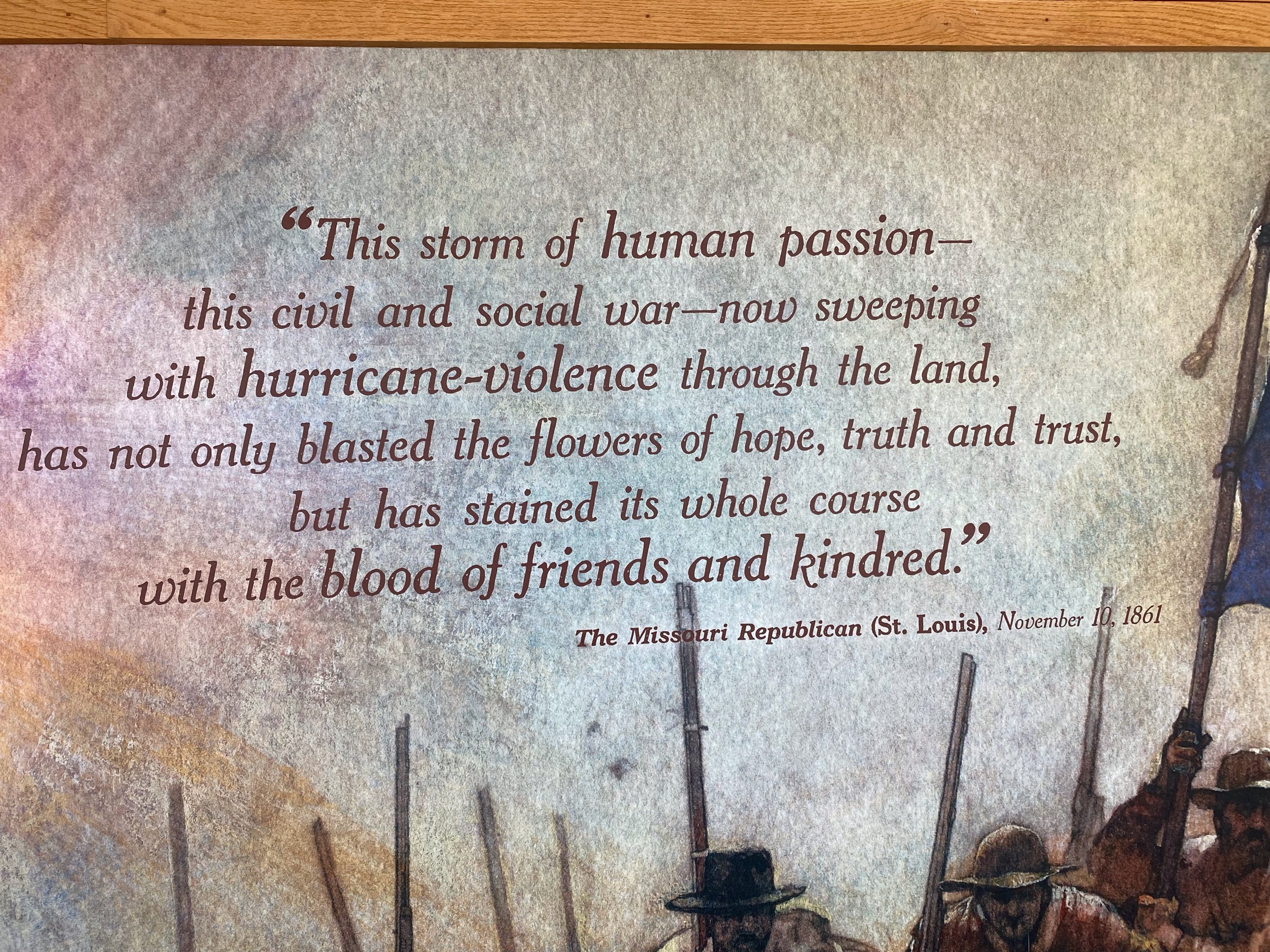
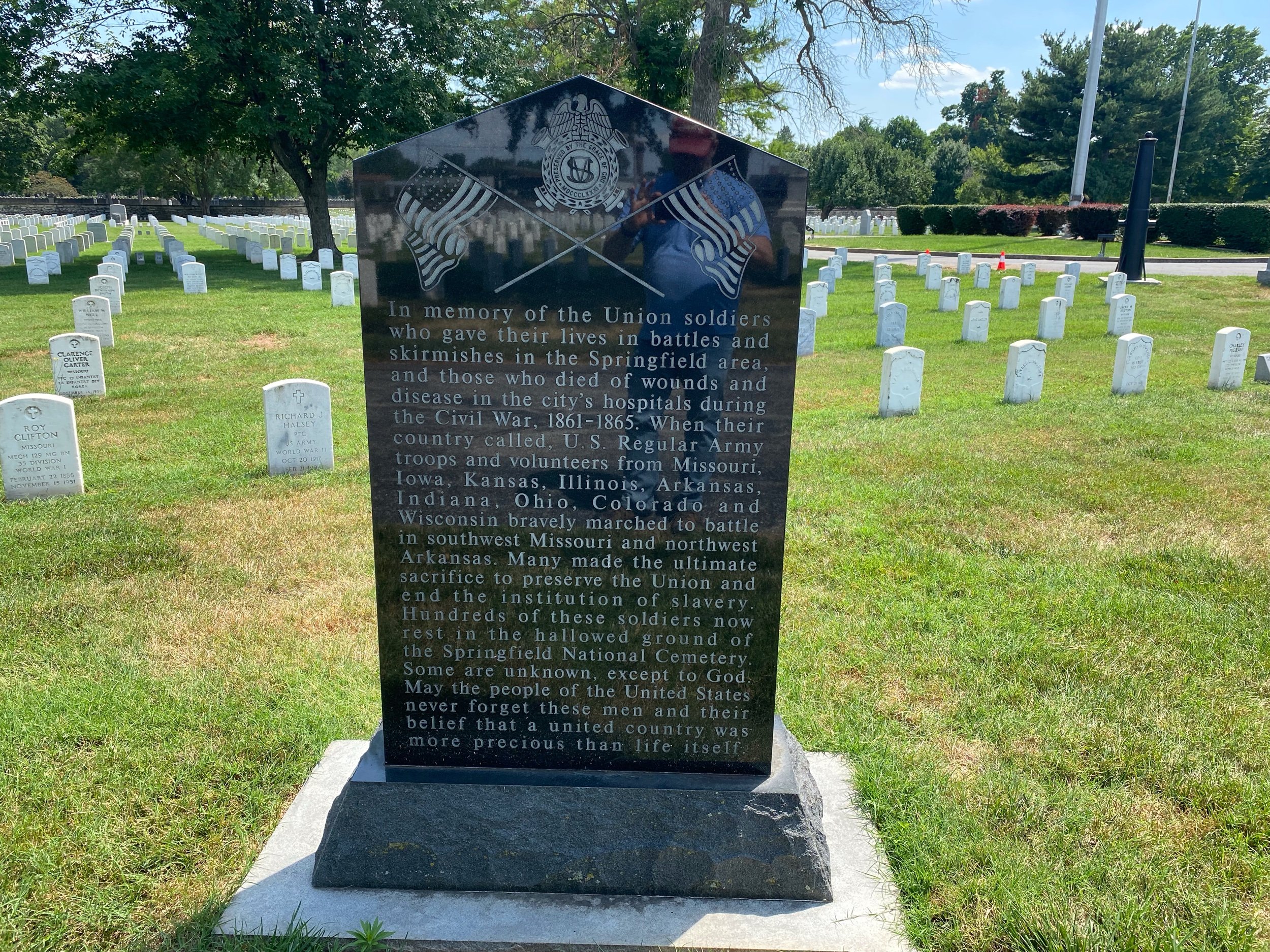
This was seen as a victory for the Confederates. They held the field after 5 hours of fierce fighting. Over 500 men lay dead or dying on Bloody Hill. Union losses were 1,317 and 1,222 for the Confederates. The Southerns, victorius on the field, cold not pursue the Northerners, Lyon lost the battle and his life but achieved his goal. Missouri stayed in Union control.
Wilson’s Creek Battlefield is an amazing place to visit. A recent $4 million dollar remodel of the museum, not only modernizes the facility, but brings a fresh view of this civil and social war. Exhibits brought a more humanized look at the war from all stake holders and highlighted the toll that was paid. Ken Burns helped with a documentary movie that was 28 minutes long but excellent. A digital map helped reinforce the movements on the field. Overall, top notch.
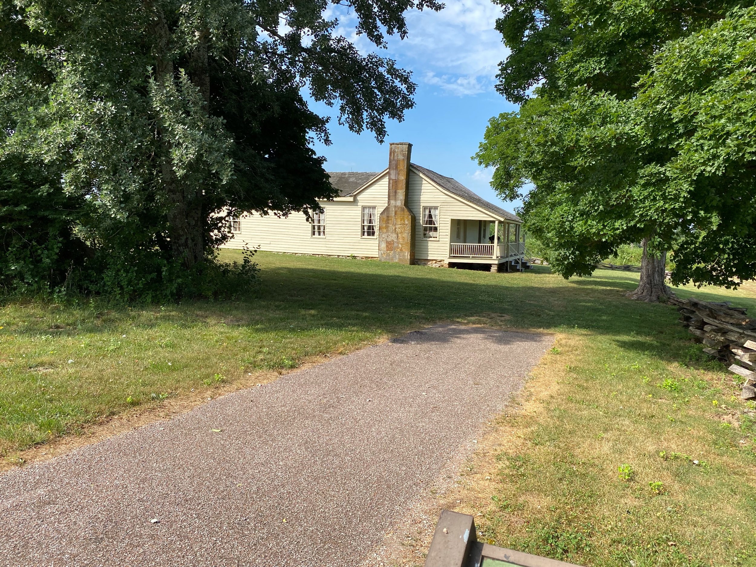
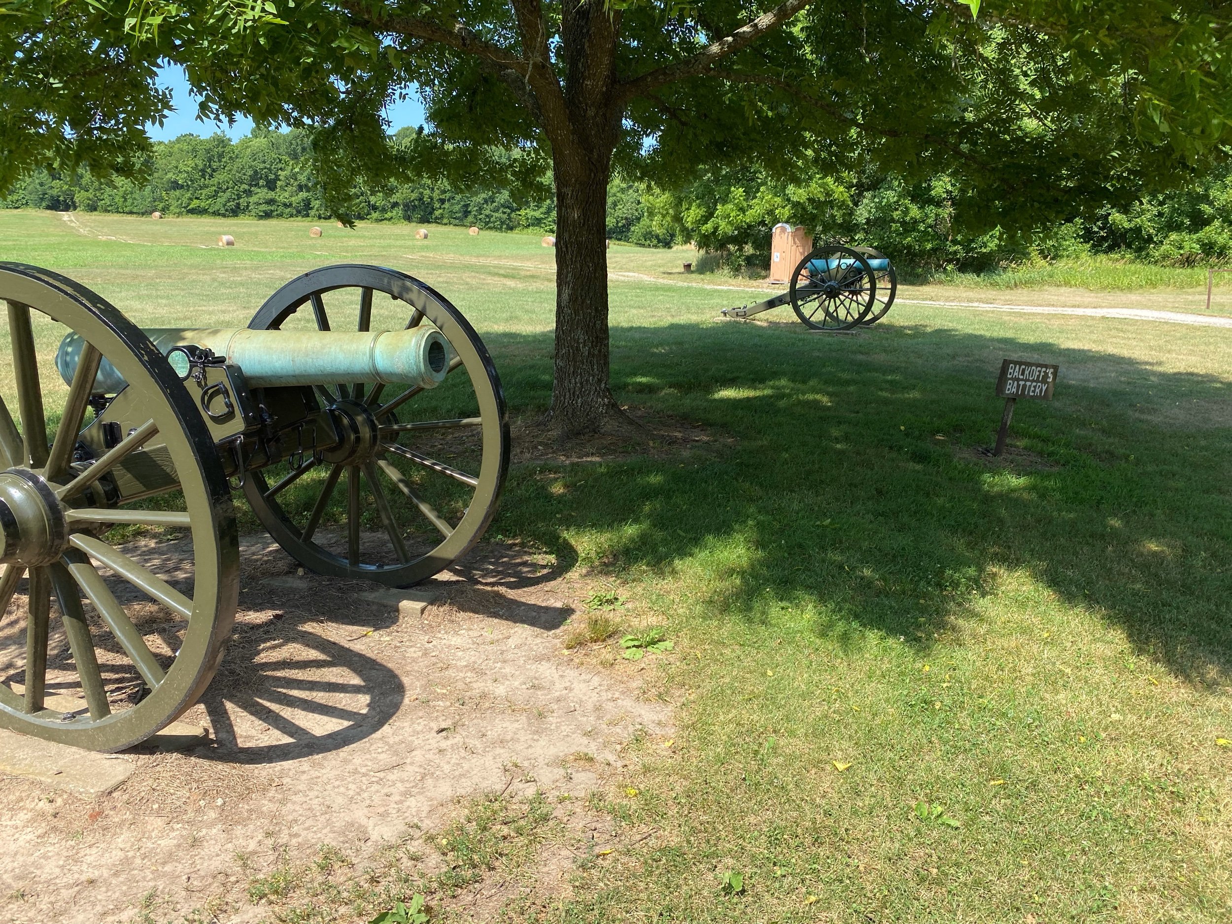
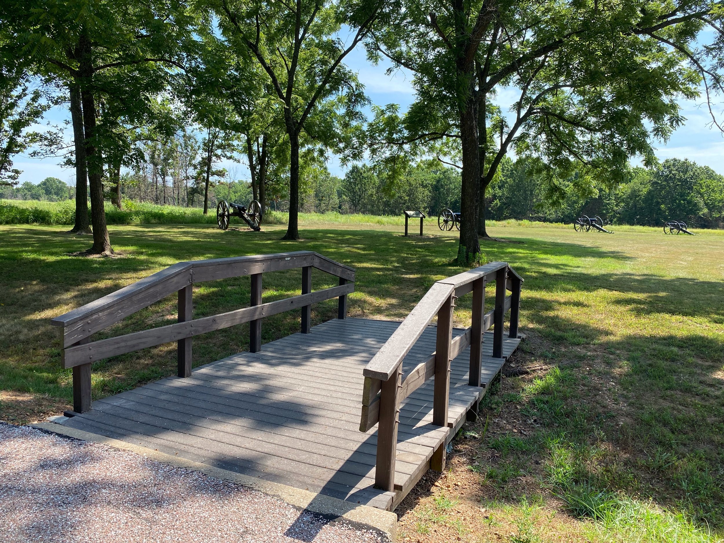
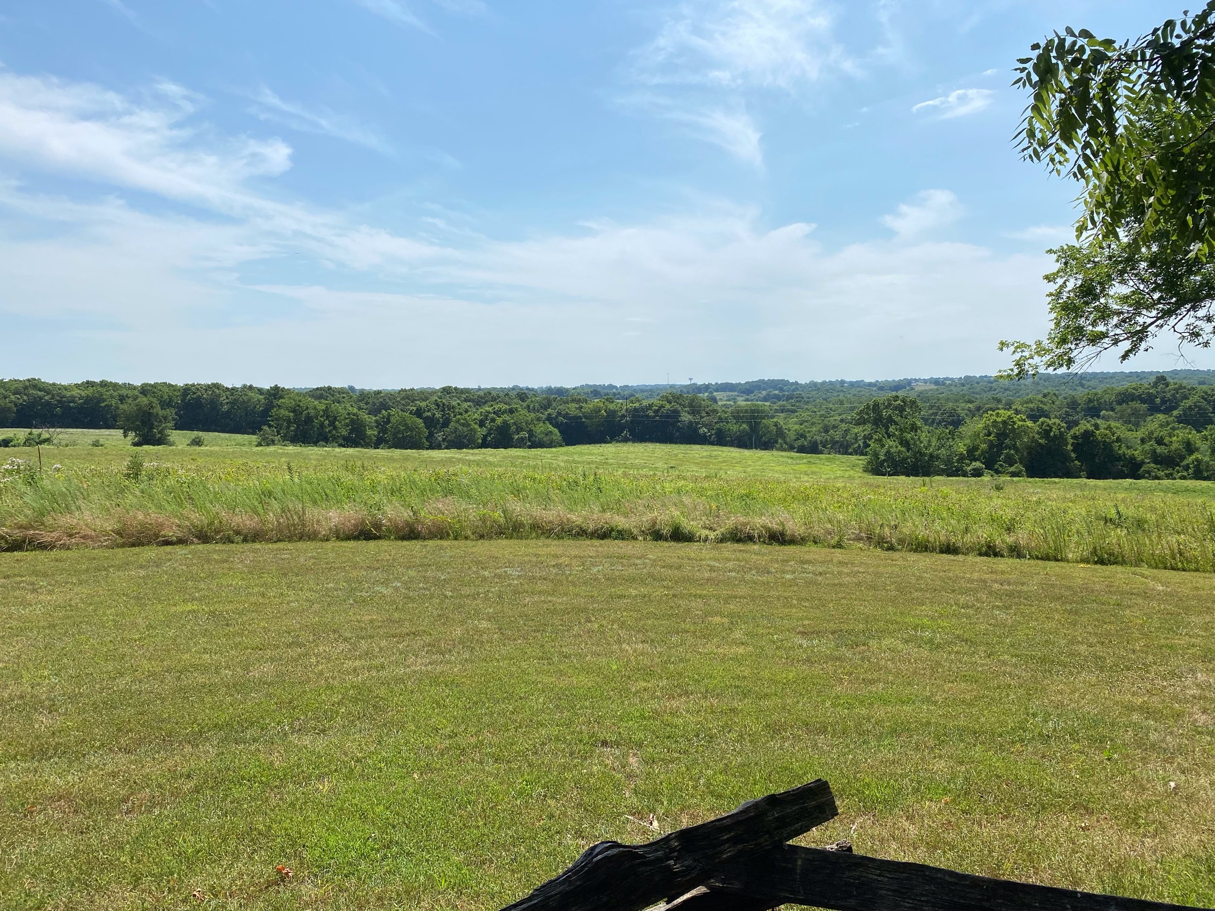
The field itself was outstanding. The battlefield is all contained and separated from any modern structures. You cannot see or hear modern society anywhere. There is a road that circles that battlefield with 8 stops with signage and information. Most impressive was the Ray house and cornfield. The home is the only structure that is still present from the battle. It has been well preserved and restored. The large family and slaves who lived there, hid in the root cellar as the battle raged around their home. After words the 12 children helped with the immense number of wounded. Their home became a hospital. On the day I visited there was a volunteer at the home that told wonderful stories about the home and the family. This was a happy surprise.
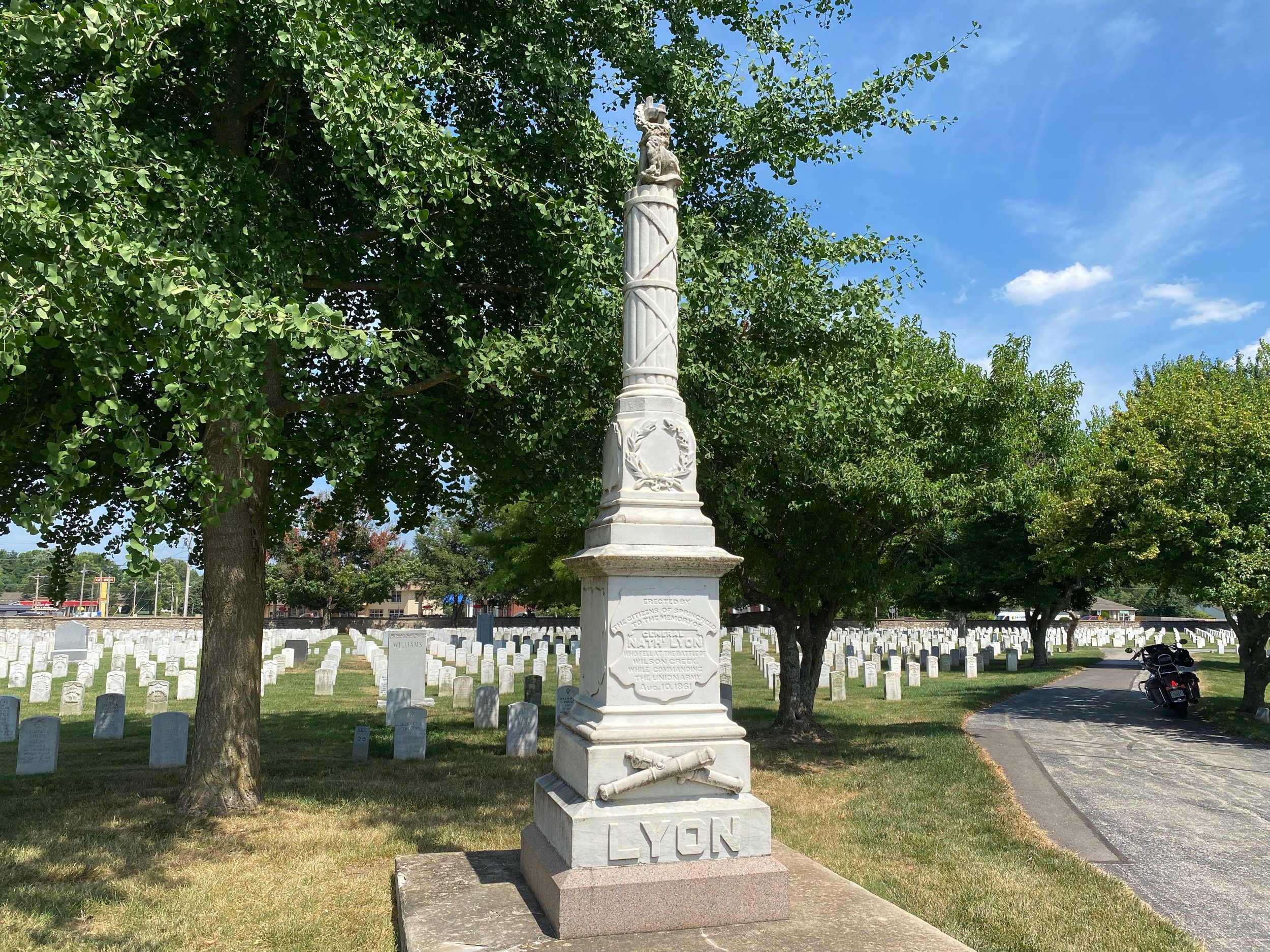
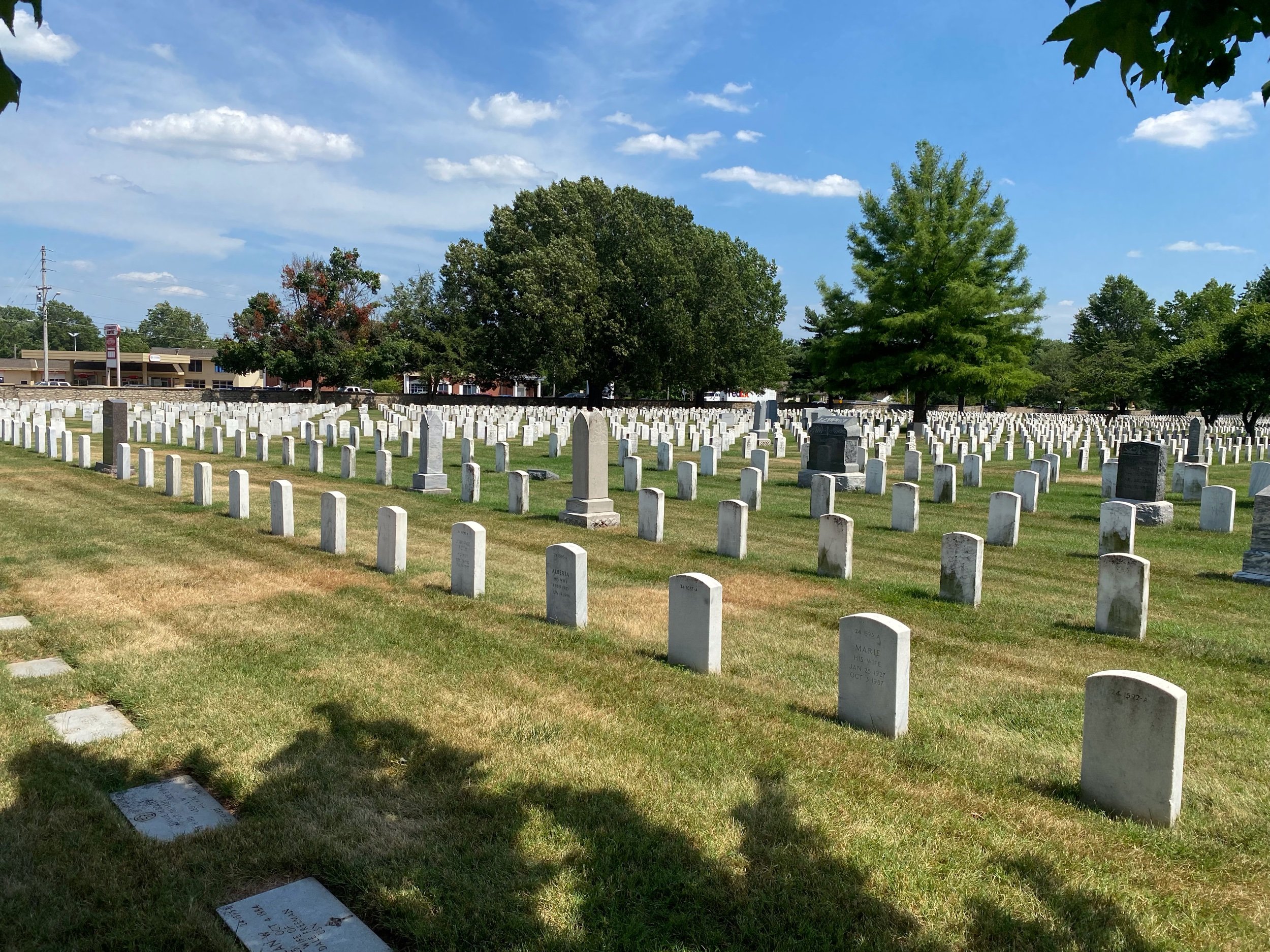
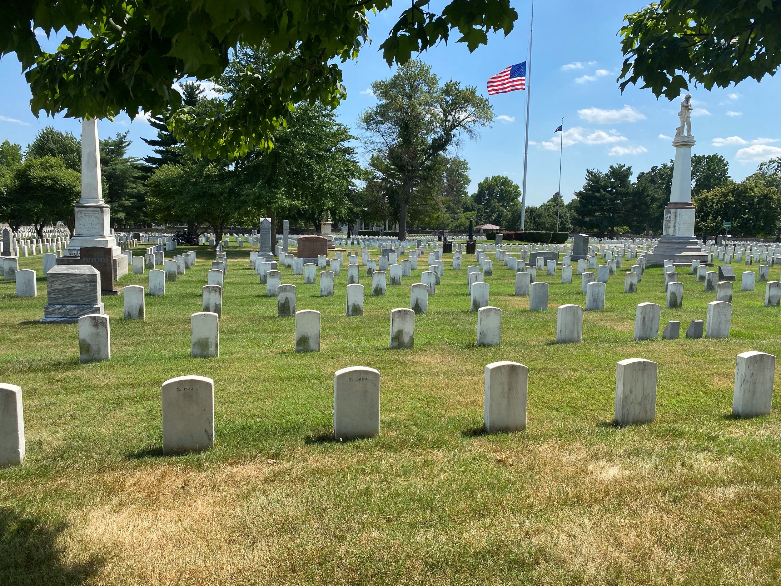
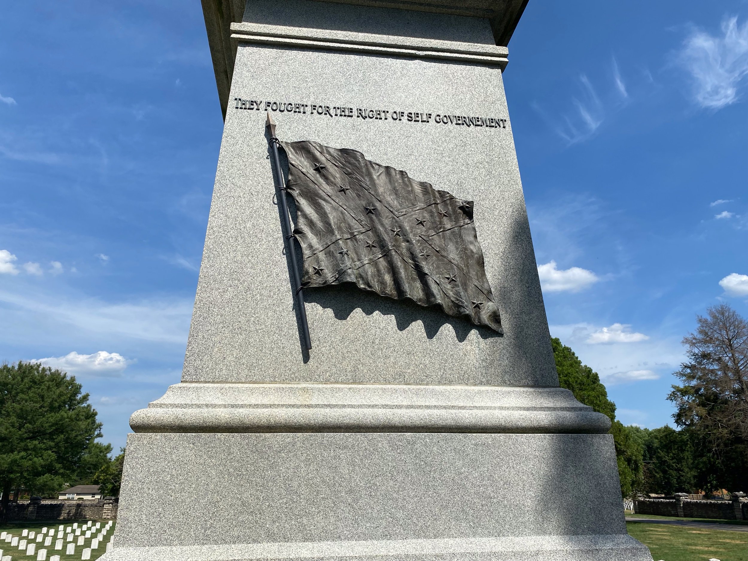
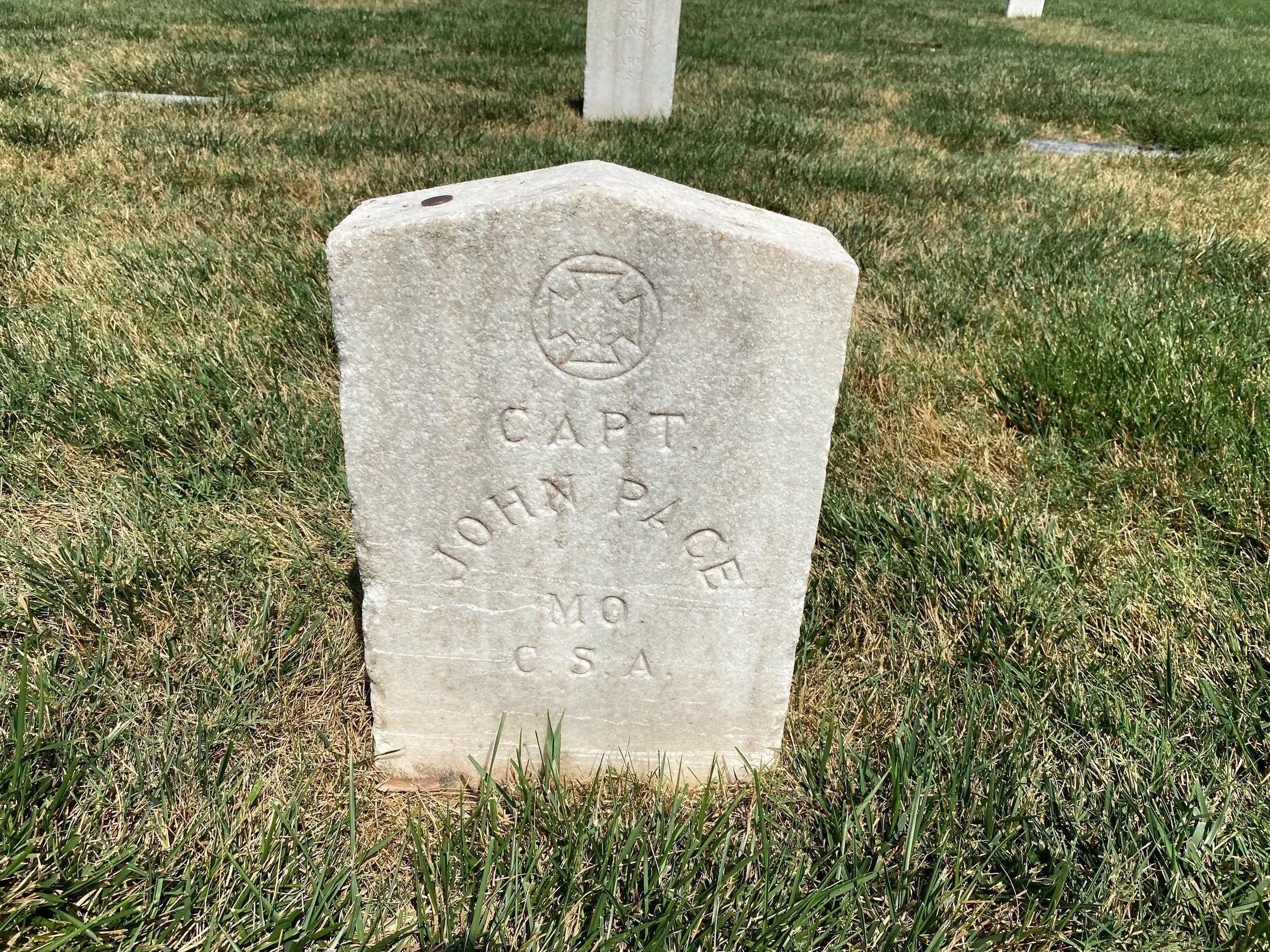
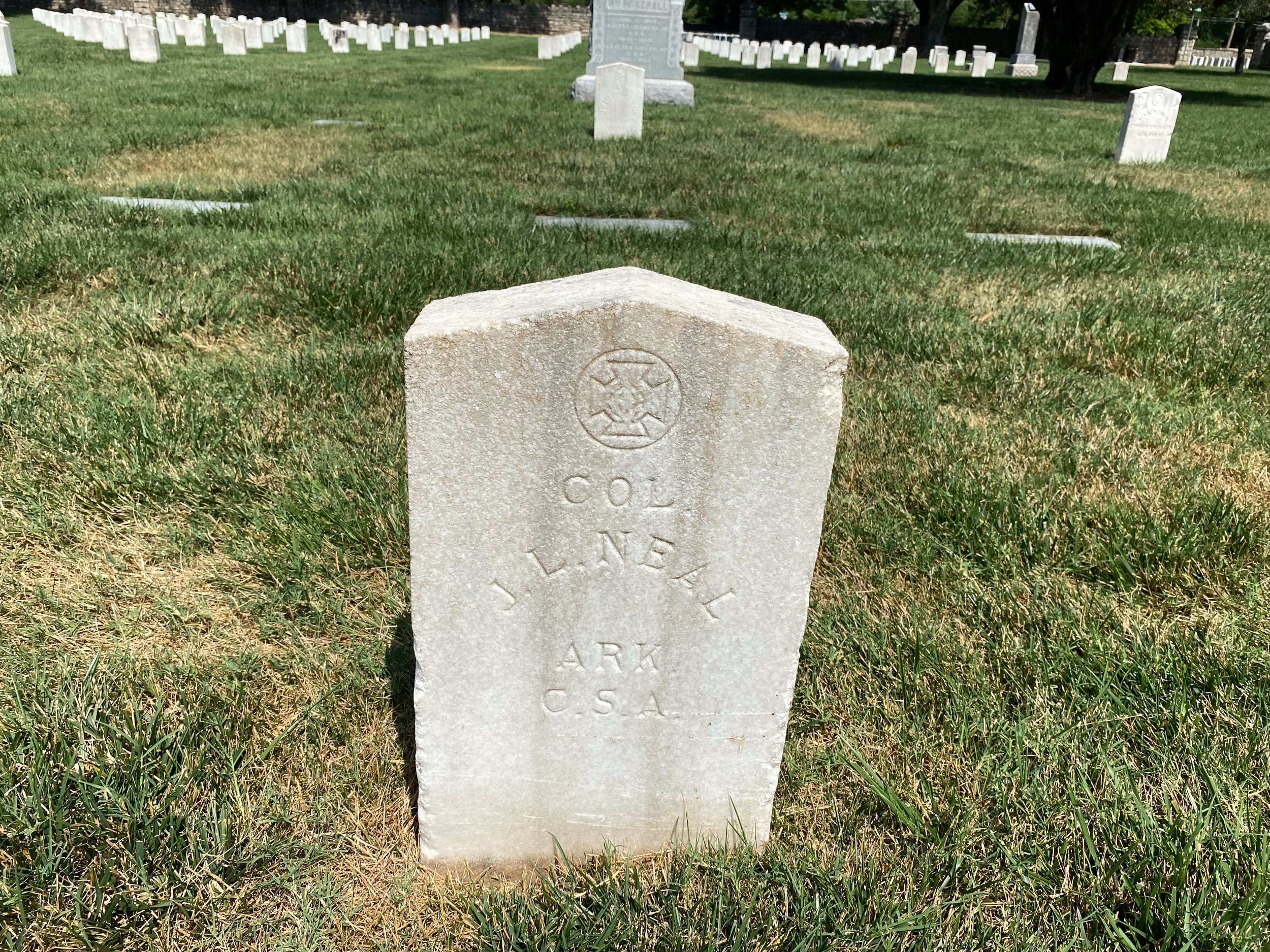
There are no monuments on the battlefield. There is a marker where Gen. Lyon fell dead, but nothing else. I thought there was a Monument for Lyon, I had seen it in a book. The park service told me that this was a story with much controversy. The Lyon monument was originally placed in the Springfield town square. After a year in it’s place, it was deemed to large and moved to the Springfield National Cemetery with a lot of the other Union dead. It was not that large, there was a contingent of post reconstruction confederates that did not want to see Lyon the martyr in the square.
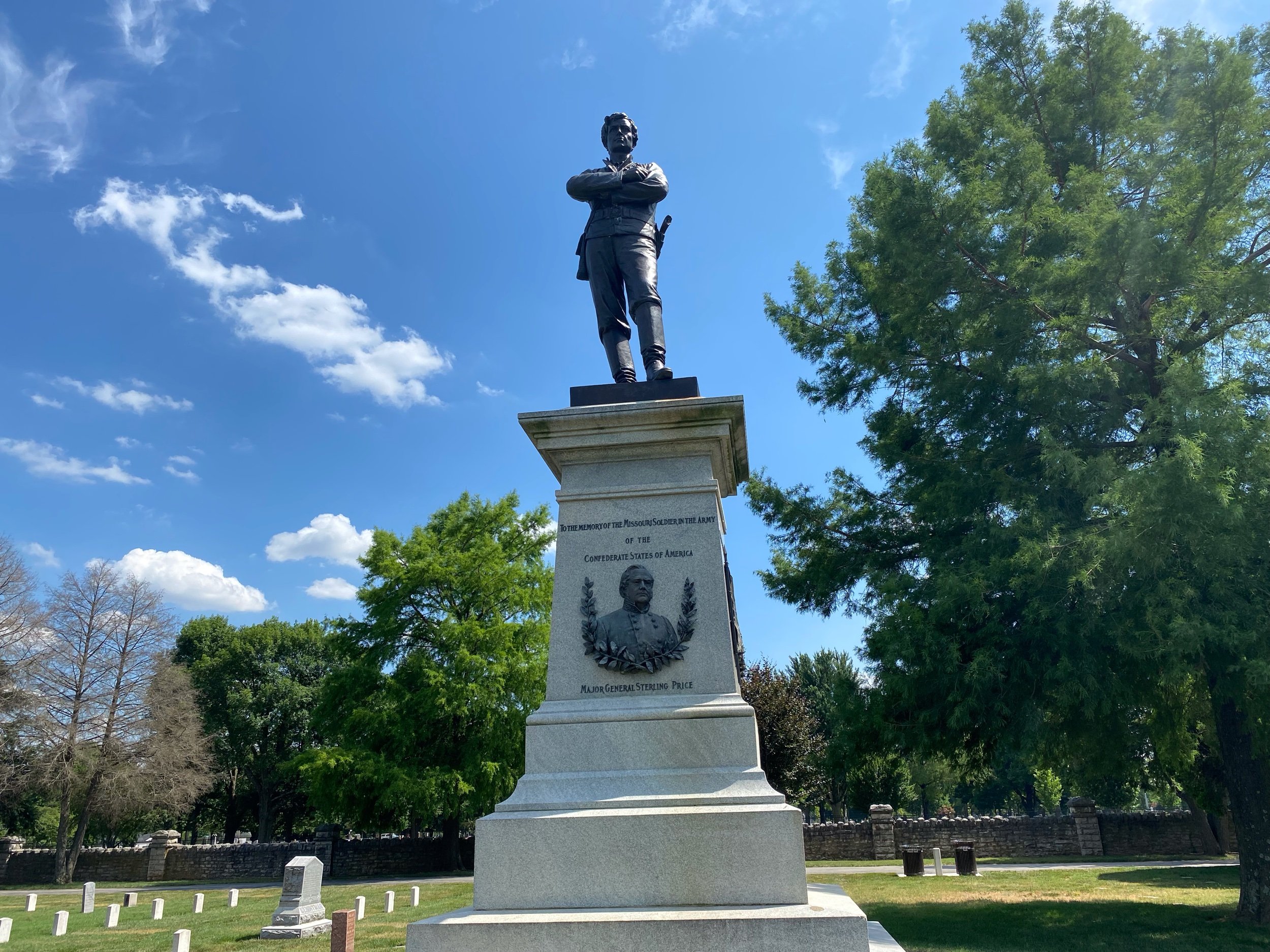
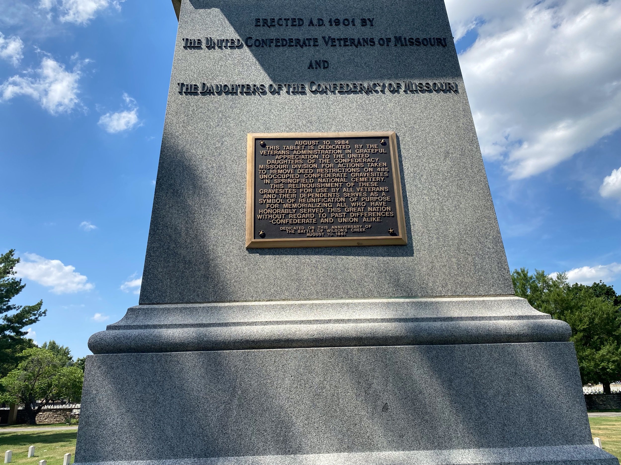
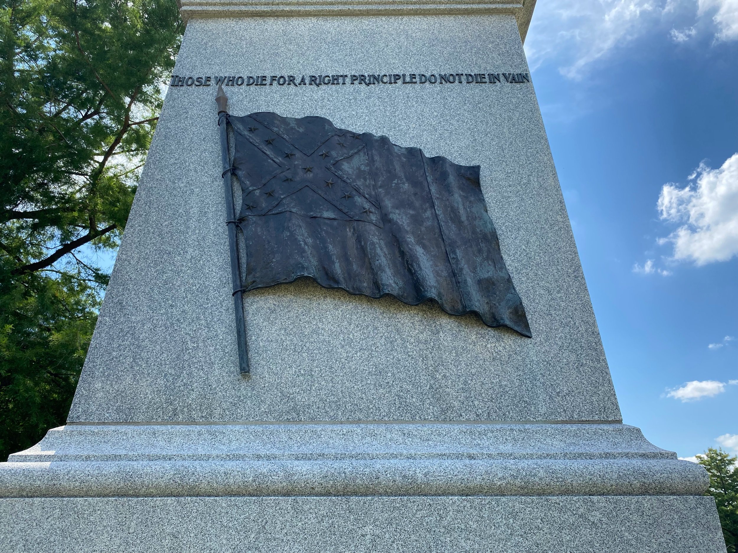
I took a sweltering ride out to the Springfield National Cemetery and found the subtle monument. It was positioned with many union head stones marked “Unknown”. It took some pictures and put my helmet on to ride out. As I was riding I saw a large monument behind a stone walled area and I rode into there. The monument was for Maj. General Sterling Price and commemorating the Missouri Soldier of the Army. It was placed there in 1984! Stars and Bars and all. Saying they Fought for Self-Government. I saw that and realized the “Cause” was still alive in 1984, if not today. It also hinted at me, why every time I met a park ranger or volunteer they would ask “Where are you from?” I wonder if you get a little different story if you are a carpet baggier northerner.
It was an amazing visit. I love visiting battlefields on my motorcycle. I strap my helmet on the back, have a cooler with drinks and snacks, and reference materials in the saddle bag. It is so easy to jump off, run and read a sign, or turn around and look at something you might have missed. I now say motorcycles are made for mountains and touring civil war battlefields.
The pool was open when I got back to the KOA. It was 103 degrees in the shade when I parked the bike and jumped into the pool. Tomorrow I am off to St. Louis to spend a few days with Cory.
Take care!